Legendary Routes

Route des Grandes Alpes

From Lake Geneva to the Mediterranean over 17 passes

AT A GLANCE

The route in numbers.

687 km

Distance

2.764 m

Highest point

Asphalt

Surface

17

Mountain passes

Medium

Difficulty

SeasonWinter closure High passes approx. late October – mid-June
  1. Januar: Closed
  2. Februar: Closed
  3. März: Closed
  4. April: Closed
  5. Mai: Closed
  6. Juni: Best time
  7. Juli: Best time
  8. August: Best time
  9. September: Best time
  10. Oktober: Closed
  11. November: Closed
  12. Dezember: Closed

WARUM DIESE ROUTE

Warum die Route des Grandes Alpes?

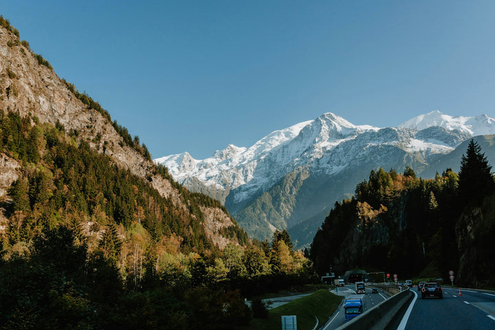
The Route des Grandes Alpes links Lake Geneva with the Mediterranean. It crosses the French Alps – over the Colombière, Iseran, Galibier, Izoard and many more passes all the way to Menton.

For motorcyclists, it's the classic of all classics: new hairpins, climbs and views every day, with mountain villages, bistros and bakeries in between. Once you've ridden it, it stays in your head – and as a relief, on your wall too.

Col du Galibier

Photos: Zairon (CC BY-SA 4.0), Stephan Brunker (CC BY-SA 3.0) · Wikimedia Commons

THE ROUTE

Along the route.

THE ROUTE

Along the route.

Loading map …

GPX file for sat nav and apps Download GPX
  1. km 81,8

    Col de la Colombière · 1,613 m

    The first real pass: flowing bends through the Reposoir valley, chalets with terraces at the top and views of the Aravis range. Perfect for warming up.

    Col de la Colombière

    Photo: Stephan Brunker (CC BY-SA 3.0) · Wikimedia Commons

  2. km 167,9

    Cormet de Roselend · 1,967 m

    First along the turquoise Lac de Roselend, then over open alpine meadows up to the pass – one of the most beautiful sections of the entire route.

    Lac de Roselend
    Lac de Roselend am Cormet de Roselend

    Photos: Rémih (CC BY-SA 4.0), Louis Chabert (CC BY-SA 4.0) · Wikimedia Commons

  3. km 238

    Col de l'Iseran · 2,764 m

    The highest paved pass in the Alps. Long, wide bends above Val-d'Isère, snow at the top well into summer and thin air – for the engine too.

    Col de l'Iseran
    Col de l'Iseran

    Photos: Florian Pépellin (CC BY-SA 4.0), Wormke-Grutman (CC BY-SA 3.0) · Wikimedia Commons

  4. km 345,1

    Col du Galibier · 2,642 m

    A Tour de France legend: over the Col du Télégraphe up into a barren high-mountain world. At the top, a panorama of the Meije glaciers.

    Col du Galibier
    Col du Galibier

    Photos: Zairon (CC BY-SA 4.0), Stephan Brunker (CC BY-SA 3.0) · Wikimedia Commons

  5. km 403,8

    Col d'Izoard & Casse Déserte

    Beyond the pass at 2,360 m lies the Casse Déserte: bizarre rock towers, scree and bends like on the moon. Be sure to stop.

    Casse Déserte am Col d'Izoard
    Casse Déserte am Col d'Izoard

    Photos: Olgierd Rudak (CC BY-SA 4.0) · Wikimedia Commons

  6. km 501,8

    Detour: Cime de la Bonette

    A small detour, a big impact: the loop around the Cime de la Bonette at 2,802 m is considered France's highest paved road.

    Cime de la Bonette
    Cime de la Bonette

    Photos: JCosson (CC BY-SA 4.0), Patrick Rouzet (CC BY-SA 3.0) · Wikimedia Commons

  7. km 640

    Col de Turini · 1,607 m

    Stage of the Monte Carlo Rally: tight hairpins through dense forest, bistros with rally flair at the top. Then it's downhill towards the Mediterranean.

    Col de Turini
    Col de Turini

    Photos: Jérémie Forget (public domain), Anthospace (CC BY-SA 4.0) · Wikimedia Commons

GPX file for sat nav and apps Download GPX

GEFAHREN VON

Erlebt auf der Route des Grandes Alpes.

Community

Moventerra Redaktion

Berlin8 Beiträge auf Moventerra

Wir sind Robin und Marek, die Gründer von Moventerra. Die Infos zu dieser Route haben wir sorgfältig recherchiert – selbst gefahren sind wir sie noch nicht. Du kennst die Strecke? Dann schreib uns und erweitere sie mit deinen Tipps und Fotos.

Bericht · 10/2026

Unsere Recherche zur Route des Grandes Alpes

Fünf bis sieben Tage, 17 Pässe, vom Genfer See bis ans Mittelmeer – die Route des Grandes Alpes steht bei vielen ganz oben auf der Liste.

Die Infos auf dieser Seite haben wir aus offiziellen Quellen, Reiseführern und Berichten anderer Fahrer zusammengetragen. Selbst gefahren sind wir die Strecke noch nicht. Bist du sie schon gefahren? Dann erzähl uns davon – mit deinen Tipps und Fotos wird diese Seite noch besser.

Tipp

Vor der Tour die Öffnung von Iseran, Galibier und Izoard prüfen – oft sind sie erst ab Mitte Juni frei.

AUS DER COMMUNITY

Selbst gefahren?

Erfahrungen von Fahrerinnen und Fahrern, die die Route des Grandes Alpes selbst gefahren sind.

GUT ZU WISSEN

Praktische Infos.

Road & surface

Paved throughout and mostly well maintained. On the high passes sometimes narrow, without crash barriers and with loose gravel after roadworks.

In summer, lots of cyclists are on the climbs – expect them before hairpins. On the high passes it can snow even in July.

Tolls & fees

The route itself is toll-free. Only if you arrive via the French motorway do you pay tolls (péage) – cheaper for motorcycles than for cars.

Fuel & breaks

There are enough fuel stations in the valleys, none on the passes. Fill up before the Iseran, Galibier and Izoard.

Many rural fuel stations are unattended pumps and don't accept every foreign card – a second card and some cash help.

Tips for the tour

Plan five to seven days for the whole route – ride faster and you'll see little.

Check the pass openings before your tour: the Iseran, Galibier and Izoard are often only open from mid-June.

The detour to the Cime de la Bonette is worth it – it's just a few kilometres off the route.

ERINNERUNGSSTÜCK

Die Route des Grandes Alpes als 3D-Relief.

Jede Kurve, jeder Höhenmeter – maßstabsgetreu gedruckt und mit deinem Datum personalisierbar.

€129,00

Relief gestalten

LEGENDÄRE ROUTEN

More Legendary Routes.

Pässe, Küstenstraßen und Klassiker quer durch Europa – mit Karte, Highlights und den wichtigsten Eckdaten.

Alle Routen entdecken